The Sheep’s Head Way
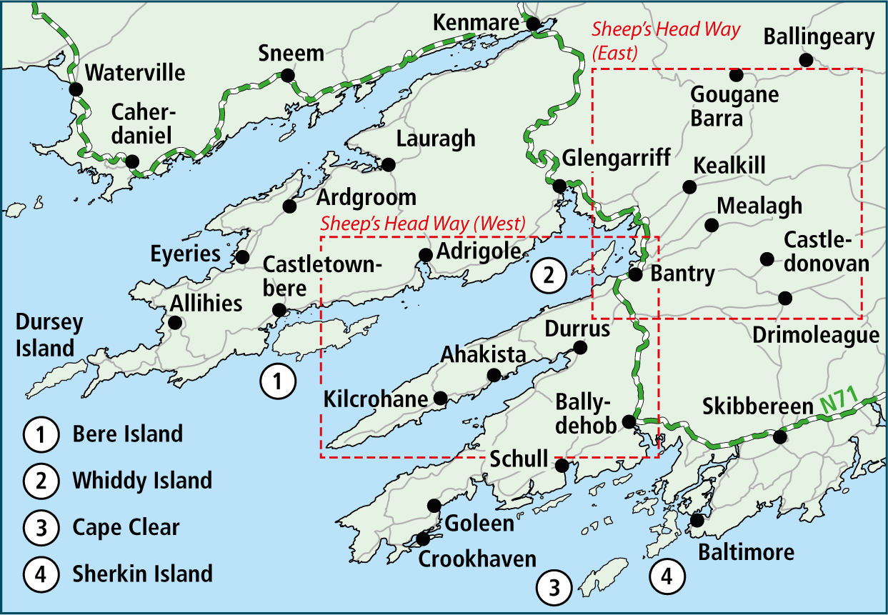
The Sheep’s Head Way is a long distance walking route that circles the Sheep’s Head peninsula and extends eastwards from Bantry through Drimoleague to Kealkill. The main trail is 178 km long, with a further 300 km in loop / linear walks. The walks start at designated trail heads, and we organise the walks into two regions:
The Sheep’s Head Way (West) starts in Bantry town, then travels the north side of the peninsula to Sheep’s Head lighthouse, returning to Bantry from the south side. It is a ridge and shoreline walk, and walkers can start or finish from any of the trailheads along the route. There are also a variety of Loop and Linear Walks in the Western section.
The Sheep’s Head Way (East) runs from Bantry to Drimoleague, Castledonovan, Mealagh and Kealkill – where the Sheep’s Head Way connects to to the Beara-Breifne Way and Slí Gaeltacht Mhuscraí. Again, there are also many Loop and Linear Walks in the Eastern section.
Please bear in mind that the maps on this website are a snapshot in time and the walks could be subject to re-routes or improvements.
Overview of the Main Trail and Loop/Linear Walks
The trails of the Sheep’s Head Way are shown below. The main walk is yellow and dashed-black, and the loops and linear walks are different solid colours. Major and minor trail heads are also shown. The map has many useful features and you can learn about them here.
Trail Markers
All walks on the Sheep's Head Way are way marked. In some places a physical trail surface has been constructed and we ask that you use the paths provided. These paths are to ensure that natural environment is preserved and so that future generations can also enjoy the walks.
There are two main types of trail markers, the main trail markers and the loop & linear markers.
Main Trail Markers
These markers are black plates with a yellow walking person on them.

Loop & Linear Markers
These are circular plates with a coloured arrow on a yellow backing. The name of the trail is written along the edge of the plate.

Signage
There isa variety of other signage on the walks as well:

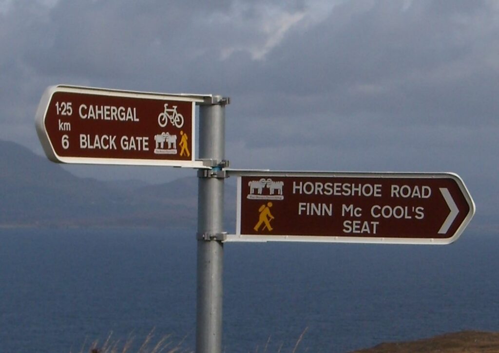
Road signs show distances to trail heads and towns and villages.

There are also signs marking car parks and heritage sites
Trail Grades
It is important to check the trail grade of a walk you intend to do. These grades are a guide as to the level of experience and fitness need on the trails. Please note that they are only a guide, and that an outdoor activity such as hill walking requires good judgment and physical fitness.
Easy
Generally flat trails with a smooth surface and some gentle slopes or shallow steps. These trails are generally suitable for family groups including children and the elderly. Normal outdoor footwear can be worn.
Moderate
These trails may have climbs and may have an uneven surface where the going is rough underfoot, with some obstacles such as protruding roots, rocks etc. The routes are appropriate for people with a moderate level of fitness and some walking experience. Specific outdoor walking footwear and clothing is recommended.
Strenuous
These are physically demanding trails, which will typically have some sections with steep climbs for long periods and the going underfoot can be extremely rough including many obstacles. Suitable for users accustomed to walking on rough ground with a high level of fitness. Specific outdoor walking footwear and clothing required.
Very Difficult / Hard
These routes are predominately in remote upland areas. They will typically include steep slopes and have variable and rough underfoot conditions, on sometimes indistinct trails. They may be unmarked so the use of a map and navigational skills will be required. Suitable only for the very fit and competent mountain walkers with a high level of experience. Specific outdoor walking footwear and clothing required.
Trail Safety
- Please ensure you have proper hiking footwear and rain gear. Also bring adequate water / drinks and food with you.
- Carry a mobile phone and inform someone about your planned route.
- Be aware that weather conditions can change quickly.
- Please stay on the marked trails, and take care near streams in flood.
- Please be aware there will be livestock on the land. At certain times livestock could include nursing cows and bulls.

Unfortunately NO DOGS are allowed on The Sheep's Head Way.

- Always keep livestock in view and do not turn your back on them.
- Walk carefully and quietly around them.
- If livestock approach you on a trail, turn round to face them. If necessary take a couple of steps towards them, waving your arms and shouting firmly.
- Above all, do not put yourself at risk. If you feel threatened, do your best to find another way around that is safe, returning to the original path as soon as possible.


